New version of our most popular applications for ZWCAD received Service Pack update - check what's changed
ZWTraffic 2025 and ZWGeo 2025 are one of our most popular applications for ZWCAD. They've received big updates with new Service Pack 1, mostly new functions but also changes requested by our users.
List of changes:
- ZWTraffic: Sign Library
- ZWTraffic: Passability
- ZWTraffic: adding sign's faces
- ZWTraffic: dividing line
- ZWTraffic: minor changes
- ZWGeo: new module - ZWMaps
- ZWGeo: Visibility
- ZWGeo: Open Street Map changes
- ZWGeo: selection
- ZWGeo: minor changes
Changes in ZWTraffic 2025 SP1
New features of the Sign Library
Signs related to waterways and sets of popular signs have been added to the Sign library. Both categories can be found on the side tree.
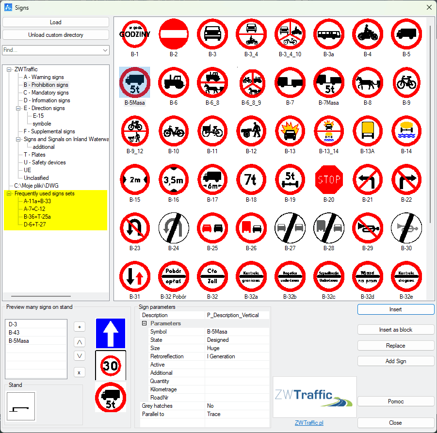
In the same menu, a post sign preview and stand view have been added so that it is more convenient to build your sign before insertion.
Changes to the Passability module
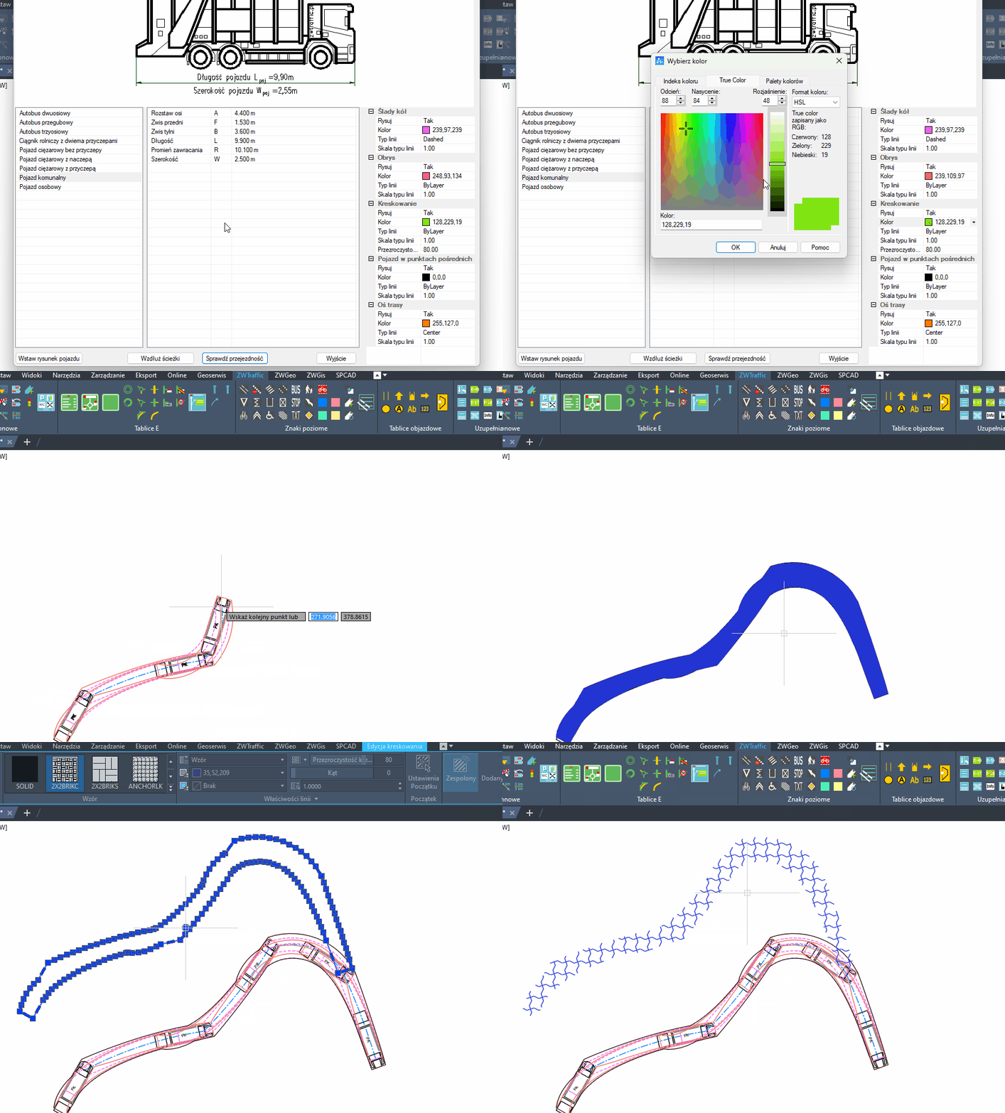
When checking vehicle passability, the selection of the colour of wheel tracks, outline, hatching, etc. has been improved.
ZWCAD also allows to conveniently change the hatching after drawing the overrun.
Adding more signs to existing ones
Adding face of signs to existing ones in a CAD drawing has become even easier. Simply select the face of the signs and click Add Sign, then indicate where to add it.
Clicking on the top of the sign face will add the new sign on top and clicking on the bottom will add the sign below the existing one.
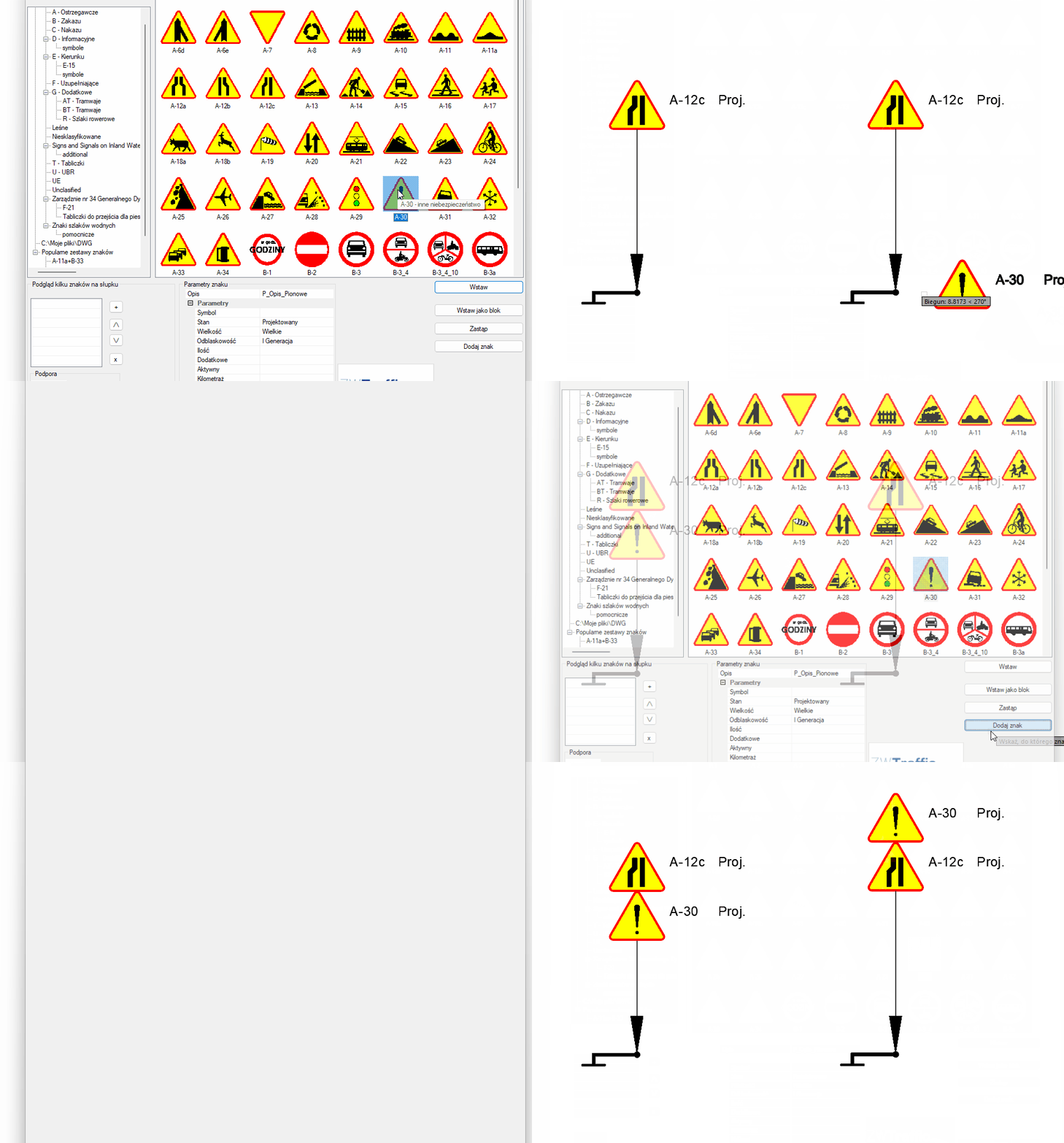
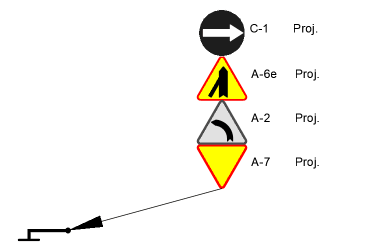
Nothing prevents the combination of regular signs together with grey ones.
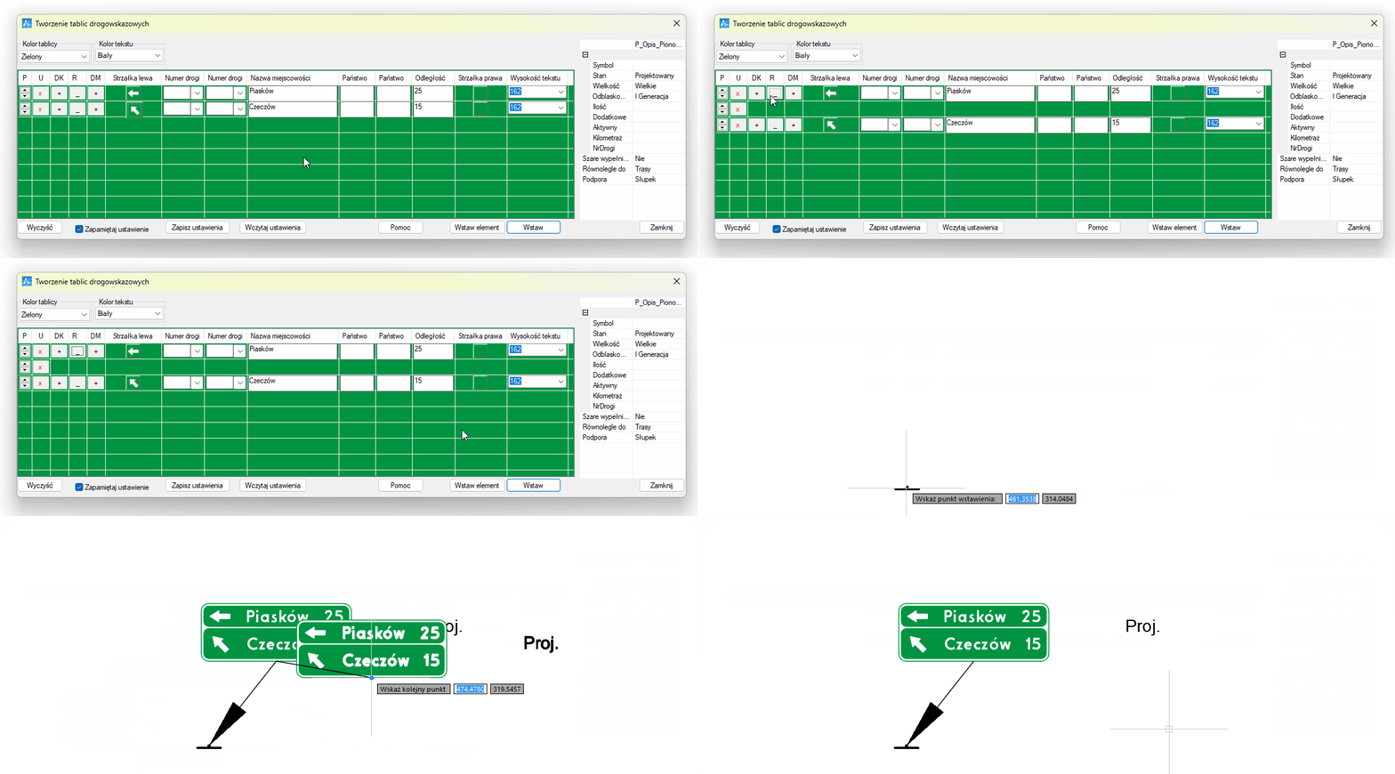
Added a dividing line in the signboard
When creating the E-1 board, the possibility of making a line separating city names has been added. Simply click on the horizontal marker to have our CAD programme insert an empty line, which will translate into a line separating the entered values.
List of changes requested by our users
Thanks to all ZWTraffic users for their suggestions.
Based on these, we have made the following changes to the programme:
-
fixed a problem which occasionally occurred when creating horizontal character sets - path...configs is locked,
-
improved function of inserting Spot Reflective Elements (ZWTRAFFIC:PEO command),
-
added location saving when importing and exporting templates when creating directional and locational signs,
-
added a D-18 sign with an arrow,
-
improved functionality of the Berlin Pillow,
-
improved visibility of arrows and directions on a white background,
-
improved the insertion of direction signs in paper space,
-
changed the descriptions of the colour areas in the collation to be more readable,
-
modified the F-6 sign generator to make it more convenient to use.
You can download the most up-to-date version of ZWTraffic here: https://cadextender.com/cad-extenders/10-road-engineering/7-zwtraffic.html
You can read more about usage of the application here: https://cadextender.com/guides.html
Changes in ZWGeo 2025 SP1
New module - ZWMaps
The ZWGeo application also includes a ZWGis module for working with industry files such as SHP, WMS, WFS and GML. This module also includes tools for importing maps, points and raster underlays.
In the SP1 version, we also added a third tab - ZWMaps.
This is a database of BDOT500 geodetic base map symbols.
- library of symbols for topographic objects,
- land and building register,
- land development,
- administrative boundaries.
The symbols are in line with Polish BDOT500 regulations, but they're also usefull in other countries.
ZWMaps allows you to insert, draw or replace special objects using convenient commands.
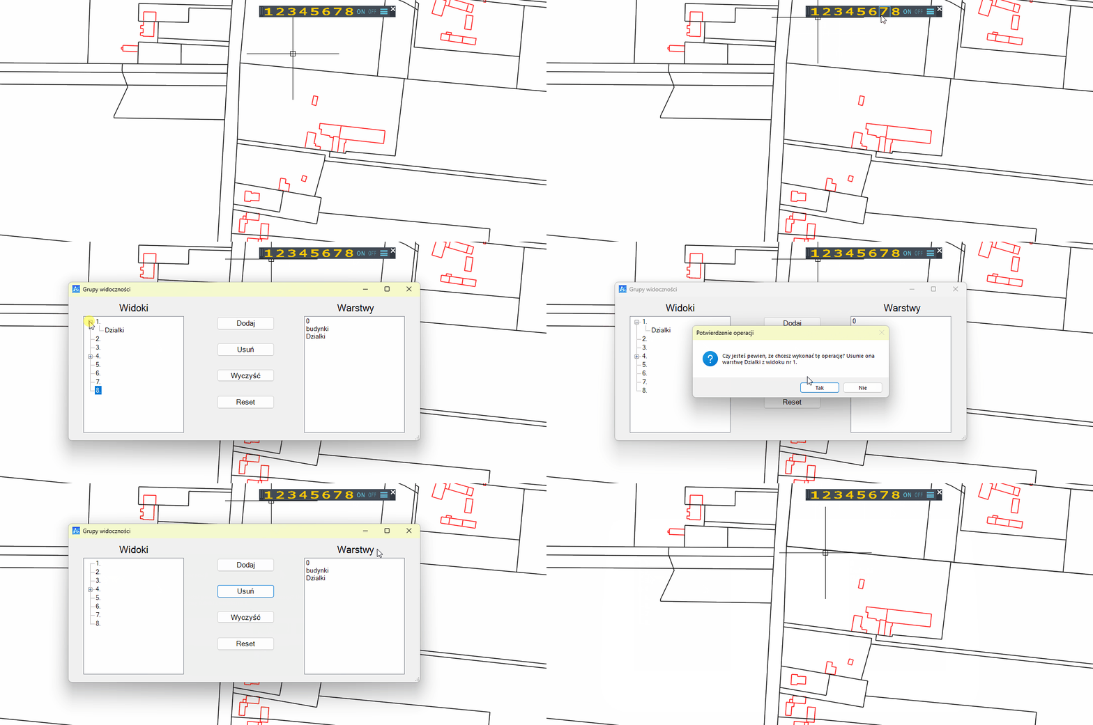
Changes in Visibility
The Visibility module makes it convenient to hide parts of the drawing. We've introduced a convenient configurator that allows saved CAD layers to be changed in Visibility at any time.
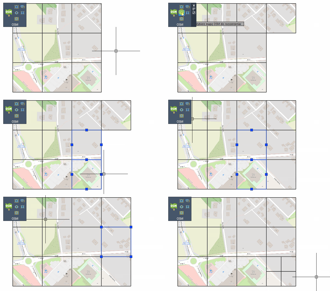
Extension of OpenStreetMaps support
In addition to a convenient tool for inserting OSM maps into ZWCAD, our addon now has several additional tools, such as changing size of maps, splitting it into smaller segments or zooming out.
New selection options
Four new functions have been added to the ZWGis tab. They're used for selecting objects within selected area.
Selection of objects by indicating the boundary (which are entirely within the boundary or also intersecting).
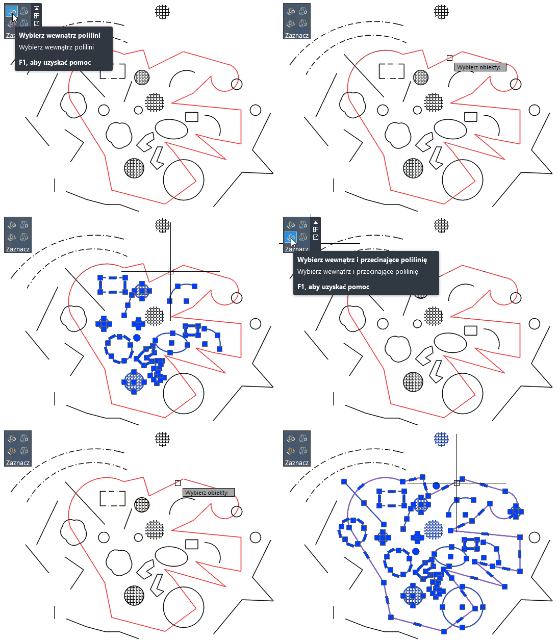
Selecting objects by indicating an internal point (being entirely within the boundary or also intersecting).
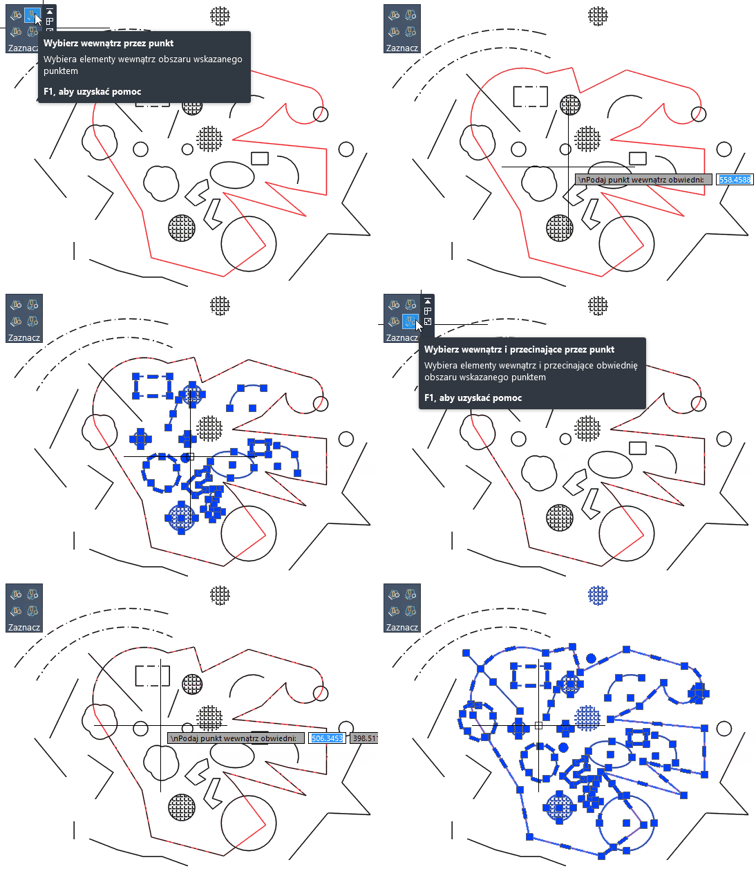
Changes in the application
In accordance with the requests and suggestions of our users, the following things have been changed:
- improved visibility of contour marking,
- improved visibility of database linking to objects,
- level designations extended,
- merging SHP labels into multiline text,
- improved hatching of areas during SHP import.
You can download the most up-to-date version of ZWGeo here: https://cadextender.com/cad-extenders/7-surveying/9-zwgeo.html
You can read more about usage of the application here: https://cadextender.com/guides.html
