As another part of our customers' support, we've created a script for ZWCAD for selecting objects inside a closed area
The purpose of the function is to be able to select a precisely large amount of CAD objects inside a boundary. It can be a closed polyline or a boundary itself. Surveyors can select parcels, architects can select rooms, etc.
Quick look at the function
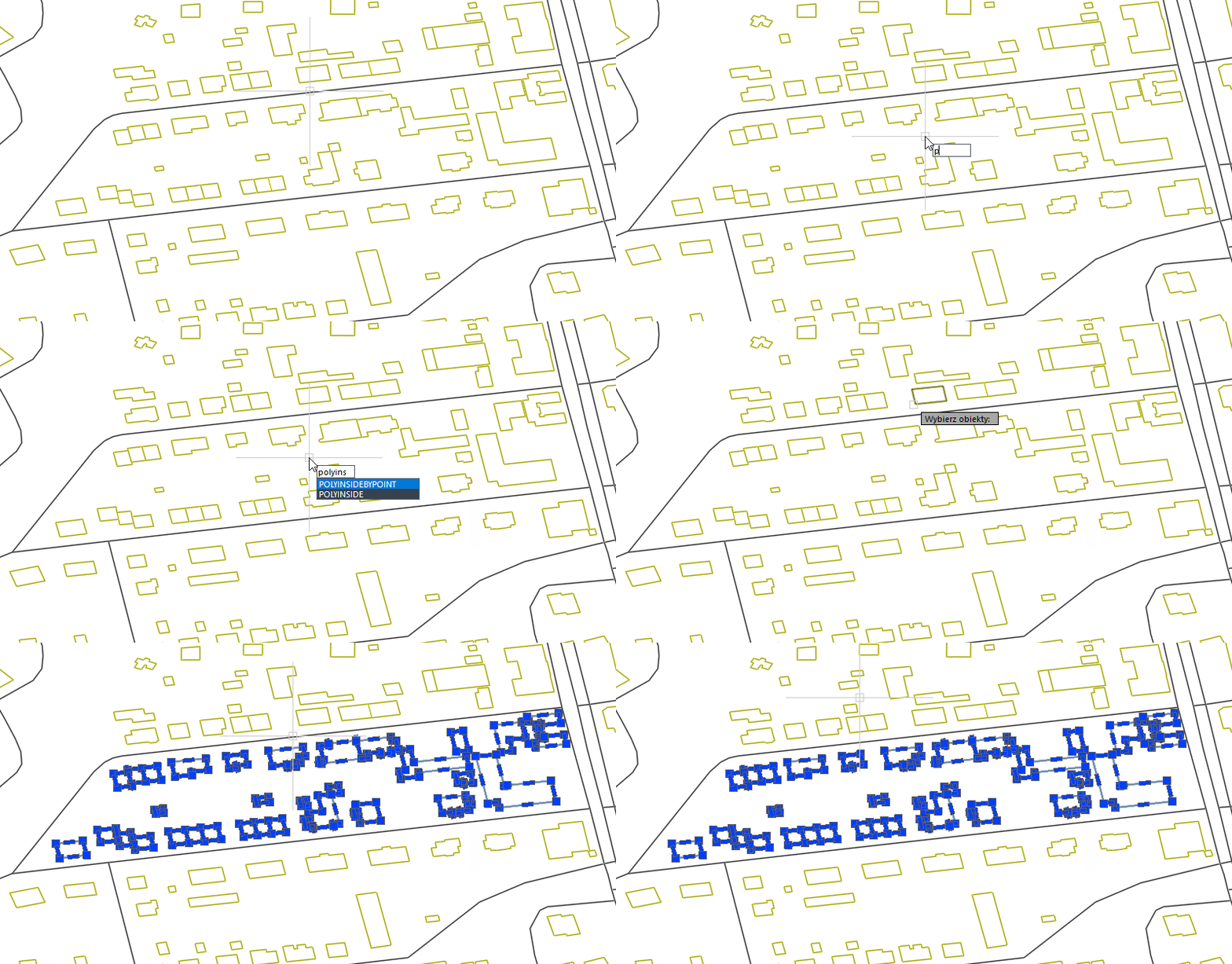
Loading the script
First, you need to download the script from here.
After it's done, you need to unlock it in file properties so it can be used. Simply right-click on the file and choose Properties.
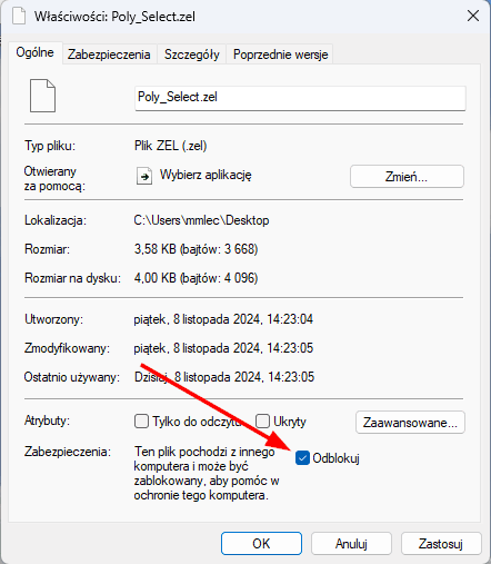
After doing it, you can simply drag the file into ZWCAD so it'll be loaded. The command bar will prompt you with such lines:
Polecenie: (progn (load "C:/Users/mmlec/Desktop/Poly_Select.zel")(princ))
# Skrypt do zaznaczania obiektów wewnątrz zamkniętej polilinii.
# Po wczytaniu skryptu będą dostępne 2 nowe polecenia:
# - POLYINSIDE - zaznacza obiekty znajdujące się w całości wewnątrz polilinii,
# - POLYCROSSING - zaznacza obiekty wewnątrz i przecinające się z polilinią.
# www.zwcad.pl
How it works
As you can see, beside the link to our Polish website, you have 2 new commands:
- POLYINSDE,
- POLYCROSSING.
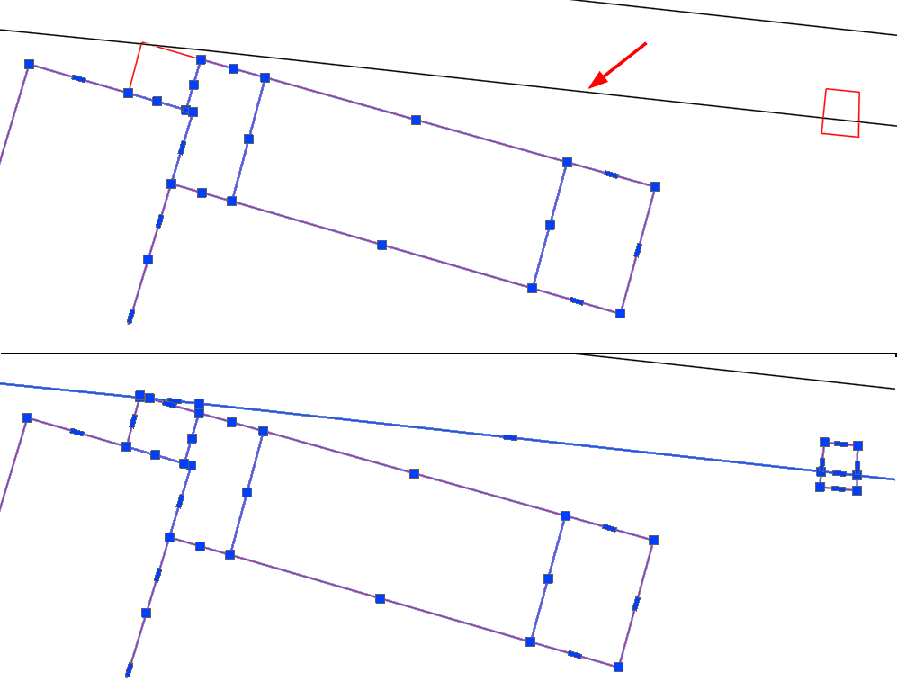
The goal for those functions is similar, but they have one difference in their job. It's like a green and blue selection rectangle in ZWCAD - the first command chooses only objects inside a boundary that are not crossing it, and the second one selects all objects inside AND crossing the boundary.
So let's take a look at the commands in action.
I have a parcel here that is a closed polyline.
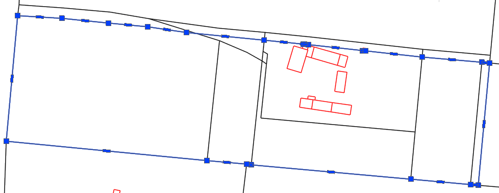
When I'll use the POLYINSIDE command, the interior of the parcel will be selected, unless it crosses at any point with the boundary.
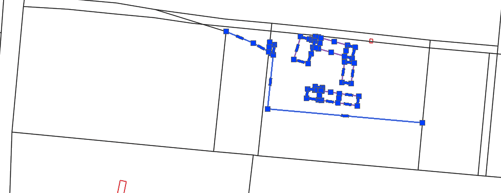
And here is the result when choosing the second option, POLYCROSSING:
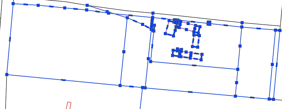
As you can see, the last function selects the polyline itself and crossing objects.
Here is a comparison on the zoomed part:
Feel free to use that script if that will help your work in any way. The same functions, but also extended by choosing an interior of any area, will be added soon to our ZWGeo application. ZWGeo is an addon for ZWCAD Professional made for surveyors and designers to help them work on maps, spatial data, coordinates, and profiles.
